Launched this week

Unfenced
Land for sale that actually borders public land
77 followers
Land for sale that actually borders public land
77 followers
Checks ~700,000 U.S. listings every week against official public-land maps and shows the ~13,600 homes and land parcels that actually touch national forest, BLM and state land. Each one is measured from its county parcel boundary: the shared edge in feet, drawn on a map, plus how much public land is behind it, elevation, road access, flood zone and wildfire hazard. Search by ZIP or state. Free, no account needed.



Hi Product Hunt! I'm David, and I built Unfenced.
In the 1980s, my grandfather and his brother, along with a few of their friends, bought roughly 240 acres of wooded land in the northern Lower Peninsula of Michigan. It backed up to thousands of acres of state land, so the property line was never really an edge. You could walk out into the woods and just keep going.
Years later I went looking for land of my own in the Poconos and wanted that same feeling. I found a parcel that borders state game lands, but getting there meant reading listings that said "near state land" and then working through county GIS maps to see whether a property actually touched the boundary or was just somewhere nearby.
Unfenced does that check for about 700,000 U.S. listings, every week. It takes each property's county parcel boundary, compares it with the USGS map of public land, and shows the ones that actually touch it, with the shared boundary measured in feet and drawn on a map.
Each property also shows:
• how much connected public land is behind it, and who manages it
• its elevation, and whether a mapped road reaches it
• its FEMA flood zone and Forest Service wildfire hazard
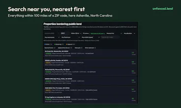
You can search by ZIP code and distance, browse by state or by national forest, or just pan the map. It's free, with no sign-up and no cookies.
I'd love feedback, especially from hunters, homesteaders and anyone who has bought rural land: what would you want to know about a property next to public land that the site doesn't tell you yet?
checking listings against public land maps is smart, such a clear pain point 🌲 is it all us states?
@petrkovacik Thanks! Yes, all 50 states plus DC, checked every week. North Dakota and DC have no qualifying properties right now, mostly because the public land there comes in small pieces or doesn’t border anything for sale.
Europe when? 👀
@busmark_w_nika Ha, I’d love to! The hard part is the listings data, there's no open feed for European property listings like we have in the US. Public land data is surprisingly good in other places like Canada and New Zealand too
Measuring the shared edge from the county parcel boundary is a nice touch. What happens when the parcel layer and the listing don't agree, say after a lot split? Do you still show the listing, or leave it out until the county data catches up?
@xenit_v0 Great question, it happens quite often. County parcel layers can lag a lot split by several months. The listing still shows, measured against the parcel at the listing’s location and the site checks the two against each other. If the listed acreage and the parcel disagree badly, like a 5-acre lot sitting on a 200-acre parent tract, the property gets a note or the acreage is withheld. Congrats on the Spiralens launch too!
This is great. A high/low price option would be more helpful than the single high filter. A view by map option would be great too.
Thanks for this, it’s now part of my home search tool bag!
@doubletough Thanks so much, good luck with the home search! The full map - unfenced.land/map already has a price range high/low and an acreage range. Every state page opens with a map of its properties. You’re right that the list pages only have a maximum price so far. I’ll add a minimum there in the next update.